Dubai Municipality, in collaboration with the Mohammed Bin Rashid Space Centre (MBRSC), announced that it is preparing to launch the DMSat-1 satellite, the region’s first environmental nanometric satellite, on 20March 2021. The launch is part of a high-technology project undertaken to develop solutions to environmental challenges and address climate change. The satellite will be launched from the Baikonur Cosmodrome in Kazakhstan.
Project Objectives
Using state-of-the-artspace technologies, DMSat-1 will monitor, collect and analyse environmental data as well as measure air pollutants and greenhouse gases. The environmental satellite will also help create maps of the concentration and distribution of greenhouse gases in Dubai and the UAE and study seasonal changes in the presence of these gases.
Data provided by the satellite will be used in several areas including finding solutions to environmental challenges, developing long-term plans to address urban pollution and climate change and environmental forecasting in Dubai.This data will also help enhance the emirate’s leading role in developing quality projects and pioneering research in the domain of climate change.
The DMSat-1 project will help build new capabilities in the field of environmental research at the local level,and provide new opportunities for harnessing space technology to enhance environmental sustainability.
Local and International Cooperation
Overseen by the Mohammed Bin Rashid Space Centre, the project was implemented in collaboration with local and international research teams. Based on Dubai Municipality’s requirements, MBRSC built the satellite in collaboration with the Space Flight Laboratory (SFL) at the University of Toronto, which has a successful history of launching satellites similar to DMSat-1. MBRSC is also managing launch-related activities and developing advanced solutions to utilise the data generated by the mission. The Centre will continue to support the project by managing the provision of data generated by the project to Dubai Municipality.
His Excellency DawoudAlHajri, Director General of Dubai Municipality, said: "Essential data provided by the DMSat-1 satellite will enable Dubai Municipality to respond to global environmental changes, identify steps to combat climate change and develop long-term environmental plans. Our cooperation with the Mohammed Bin Rashid Space Centre and other academic institutions participating in this project will help our environmental studies deliver tangible results by promoting academic research, boosting ecological monitoring and contributing to our upcoming technological ventures. We look forward to continuing this partnership with MBRSC and collaborating on more projects in the future.”
His Excellency Yousuf Hamad AlShaibani, Director General, MBRSC, said: “The emergence of new capabilities and competencies is helping the country expand its expertise in using space technology to provide solutions, develop different sectors and harness new horizons in this field. Local institutions are increasingly interested in the space sector and in utilising advanced scientific methods to meet challenges. The launch of the DMSat-1 satellite supports the UAE’s aspirations in this field."
“The Arab world’s first nanometric environmental satellite developed in collaboration with the Dubai Municipality also reflects the Centre’s commitment to working closely with government agencies in the UAE to promote scientific and technical progress at the local level, especially in areas that support future planning and sustainability,” AlShaibani added.
"Right from the beginning of the project, we worked to ensure we maintained the highest international standards in line with the Centre’s strategy. After in-depth analysis, the project was implemented in close collaboration with the team from the University of Toronto, which has extensive experience in the manufacture and launch of this type of satellite," he further explained.
The launch of the satellite strengthens the UAE’s implementation of the Paris Climate Agreement, which requires the country to generate data on greenhouse gas emissions and build national capacities to study global warming. On a local level, the DMSat-1 seeks to calculate the rate of carbon dioxide emissions in relation to GDP as outlined in the Dubai 2021 Plan, study the environmental impact of the Dubai Clean Energy Strategy 2050 and the results of the UAE Energy Strategy 2050 as well as contribute to the ‘National System for Greenhouse Gas Emissions Management’ that is part of the National Climate Change Plan 2017-2050.
Project Timeline
A team of specialised engineers and project supervisors from the Mohammed Bin Rashid Space Centre have been based at the launch site at Baikonur Cosmodrome in Kazakhstan since 25 February 2021. The satellite was placed on the launch rocket on 7 March 2021 for initial preparations and tests which will continue until 12 March, the last day of inspection of instruments before launch.
The rocket will be launched at 9:07 am Moscow time (10:07 am UAE time). The satellite is expected to separate from the launch vehicle into its orbit at 2:20 pm (UAE Time), and send its first signal at 3:00 pm (UAE Time).
The project team is comprised of employees and engineers from Dubai Municipality and the Mohammed Bin Rashid Space Centre, a number of whom will be at the Mission Control Room in Dubai to manage the launch and ensure its success.
Components of DM Sat1
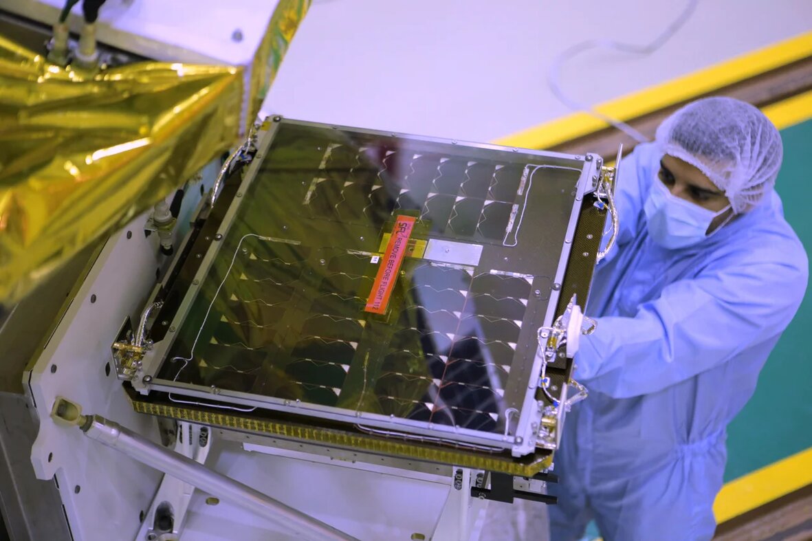
Weighing 15 kilograms, the DMSat-1 satellite contains three scientific instruments.The primary instrument is a multispectral polarimeter used to monitor air quality and detect fine particles in the atmosphere while the secondary instrument consists of a pair of spectrometers to detect greenhouse gases (carbon dioxide (CO2) and methane (CH4)). The satellite, which was manufactured in 18 months, will be capable of covering an area of up to 80,000 square kilometres each day. Data will be stored on the onboard storage system and downloaded to MBRSC’s ground station. Over a period of three to five days, the satellite will monitor a single site more than once from seven different angles. The satellite operates in three bands – blue, red and infrared. It will orbit the earth 14 times a day and will pass over the MBRSC ground station four to five times a day to receive new imaging orders and enable downloading of data.


